ArcGIS GeoService
Dataset description:
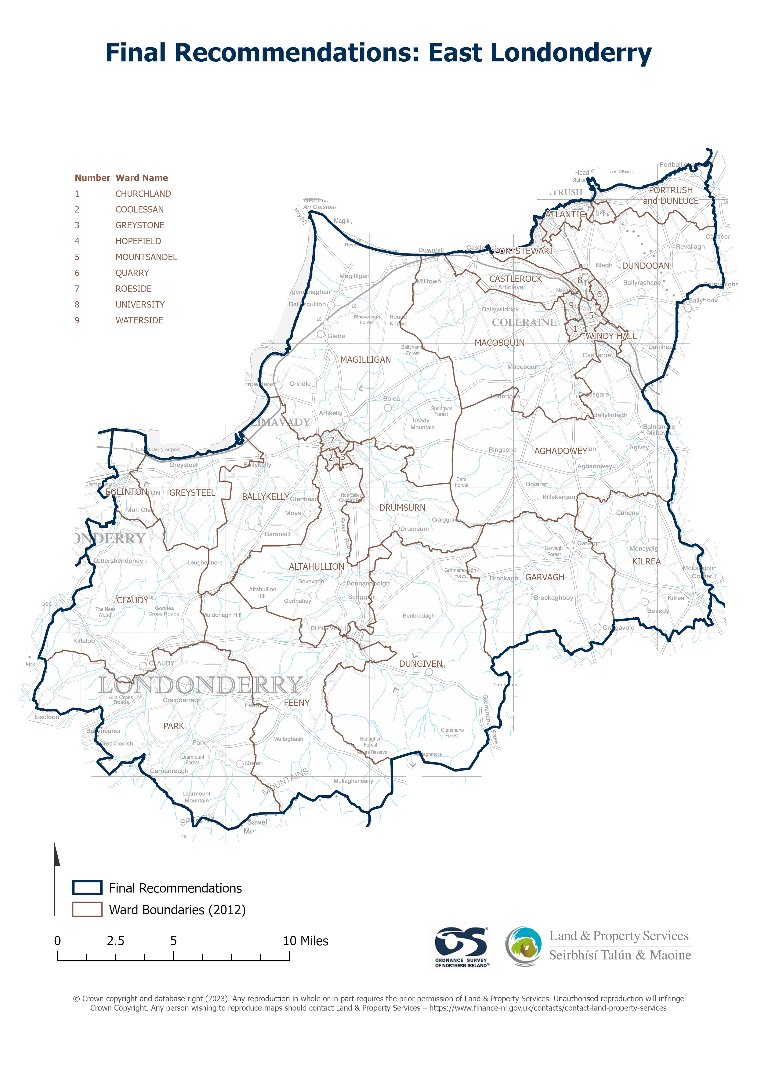
Raster download of Parliamentary Constituency 2023 of East Londonderry. The OSNI Large-scale Parliamentary Constituencies boundaries is a dataset consisting of official boundaries as...
Source: OSNI OpenData - Parliamentary Constituencies 2023 - East Londonderry
There are no views created for this resource yet.
Additional Information
| Field | Value |
|---|---|
| Data last updated | 25 August 2025 |
| Metadata last updated | 25 August 2025 |
| Created | 25 August 2025 |
| Format | JSON |
| Licence | UK Open Government Licence (OGL) |
| Access url | https://docs.spatialni.gov.uk/OpenData/OSNIOpenData_ParliamentaryConstituencies2023/PC2023_East_Londonderry.png |
| Datastore active | False |
| Distribution ref | Nd28d3564b0c047c5a41b3c3c5c3d1506 |
| Has views | False |
| Id | ab567715-de2f-4bce-90c3-e474c50a2019 |
| Mimetype | application/json |
| Package id | 418e7c15-fba6-4839-ba64-0c96d9ae99e5 |
| Position | 1 |
| Requested | False |
| State | active |